Forecasters expect the storm in the Atlantic Ocean to become a hurricane in a few days as it approaches the Caribbean.
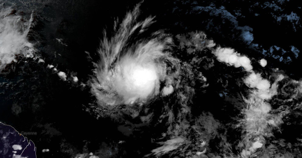
A storm system roughly 1,110 miles southeast of Barbados strengthened into a tropical storm late on Friday, gaining the name Beryl and growing closer to becoming the first hurricane of the 2024 Atlantic hurricane season, forecasters said.
The tropical storm, headed west toward the Caribbean, was expected to grow into a hurricane as early as Sunday night as it approaches the Windward Islands, southeast of Puerto Rico and north of Venezuela.
As of 10:40 p.m. Eastern on Friday, the National Hurricane Center estimated the storm had sustained winds of 40 miles per hour, gusting even higher.
The system became a tropical storm when its sustained winds reached 39 m.p.h. At 74 m.p.h., a storm becomes a hurricane.
A named storm this far east in the Atlantic is unusual for June, John Cangialosi, a forecaster with the National Hurricane Center, wrote in an advisory Friday.
“There have only been a few storms in history that have formed over the central or eastern tropical Atlantic this early in the year,” he wrote.
The storm is expected to cross the islands of the eastern Caribbean as early as Sunday night before traversing the central Caribbean Sea through the middle of next week.
Three to six inches of rain, hurricane-force winds and dangerous storm surge are possible in the eastern Caribbean Islands, including Barbados, and St. Vincent and the Grenadines Sunday into Monday.
There is a fair amount of uncertainty in the forecast about the track the storm will take, especially beyond three days.
Typically a June storm in this part of the Atlantic wouldn’t intensify into a hurricane, but the conditions in the atmosphere appear to support gradual strengthening, Mr. Cangialosi said.
Some computer weather models suggest the storm could intensify into a major hurricane, which is a Category 3 or higher.
Forecasters have warned that the 2024 Atlantic hurricane season could be much more active than usual.
In late May, the National Oceanic and Atmospheric Administration predicted 17 to 25 named storms this year, an “above-normal” number and a prediction in line with more than a dozen forecasts earlier in the year from experts at universities, private companies and government agencies.
Hurricane seasons produce 14 named storms, on average.
The seasonal hurricane outlooks were notably aggressive because forecasters looking at the start of the season saw a combination of circumstances that didn’t exist in records dating back to the mid-1800s: record warm water temperatures in the Atlantic Ocean and the potential formation of the weather pattern known as La Niña.
La Niña occurs in the Pacific because of changing ocean temperatures, and it affects weather patterns globally.
When it is strong, it typically provides a calm environment in the Atlantic. This allows storms to develop more easily and to strengthen without interference from wind patterns that might otherwise keep them from organizing.
John Yoon contributed reporting.